Hi, I'm Prasad
PhD researcher in water resources and geospatial analytics, specializing in flood and drought risk management, climate resilience, and water security. My work integrates GIS, statistical analysis, and data-driven modeling to support evidence-based policy and operational decision-making in water resources, irrigation, and flood risk management. I have hands-on experience contributing to World Bank–supported programs, preparing technical and analytical inputs, and translating complex data into concise knowledge products for capacity building and stakeholder engagement.

About
I am a PhD researcher at Lyles School of Civil and Construction Engineering, Purdue University. My research is focused on applying geospatial analytics and hydrologic science to real-world water management and policy challenges. My work is driven by the goal of bridging data-driven research with operational and institutional decision-making in water resources, climate resilience, and disaster risk management.
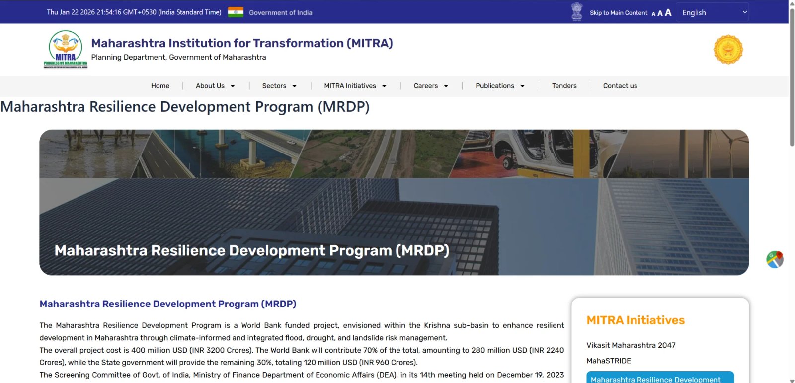
Prior to my doctoral studies, I worked on World Bank supported and government led programs in India, including flood resilience and water security initiatives under the Maharashtra Resilience Development Project (MRDP) and policy-oriented work at the Maharashtra Institution for Transformation (MITRA). I contributed to flood risk analysis, hydrologic and hydraulic assessments, geospatial diagnostics, and the preparation of technical and analytical inputs supporting state-level planning.
My experience spans flood and drought risk assessment, GIS-based spatial analysis, and statistical modeling, with a strong emphasis on translating complex datasets into concise knowledge products for policy, capacity building, and stakeholder engagement.
Skills
Work Experience
Maharashtra Institution for Transformation (MITRA), Govt. of Maharashtra
Research Officer
Mumbai, Maharashtra, India
Projects:
- World Bank Funded Maharashtra Resilience Development Project (MRDP)
- World Bank Funded Maharashtra Strengthening Institutional Capabilities in Districts for Enabling Growth (MahaSTRIDE)
Work:
- Contributed in framing Flood Resilience Strategies
- Hydrodynamic River Flood Modeling of Krishna River Basin and RS and GIS analysis
- Preparing Terms of Reference (ToR) and Request for Proposals (RFP) and uploading them on World Bank's STEP Portal

Indian Institute of Technology (IIT), Bombay
Project Research Associate
Mumbai, Maharashtra, India
Projects:
- Integrating Drought Science Management and Policy (D-SciMAP) for Managing Droughts in Water Scare Areas of Maharashtra State
- Outscaling of Managing Aquifer Recharge and Sustaining Groundwater through Village-level Interventions (MARVI) in World Bank and Government of India funded Atal Bhujal Yojana (ABHY)
Work:
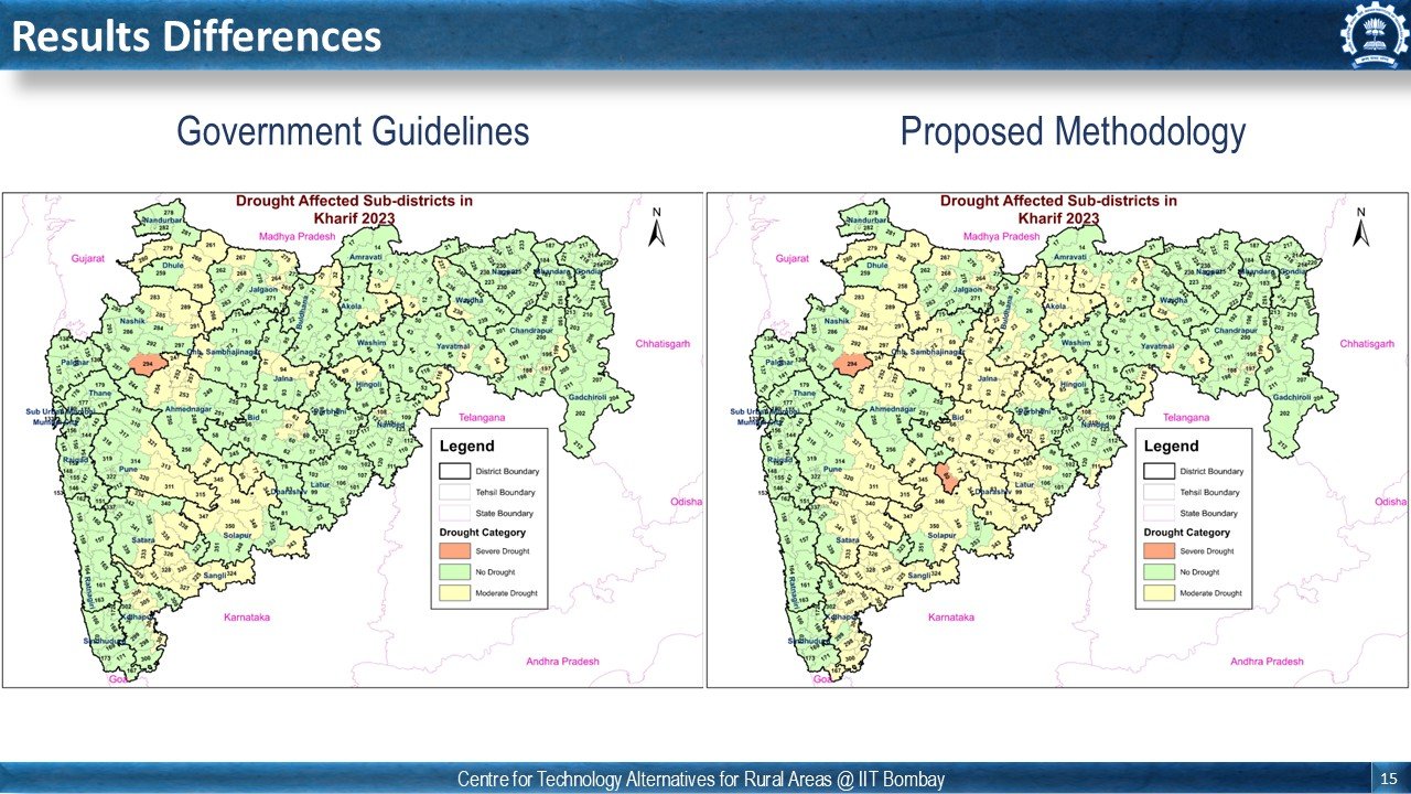
- Conducted in-depth analysis of 2023 drought in Maharashtra at sub-district level and proposed new methodology for more inclusive drought declaration criteria
- Conducted stakeholder consultations and trainings in drought prone villages to increase the groundwater level under the MARVI and ABHY project
JJARAG Geotech Solutions Pvt. Ltd.
GIS Analyst
Kolhapur, Maharashtra, India
Projects:
- Flood Inundation Mapping in and around the 5 km Buffer Region of Ambatttur Plot, Chennai, India
Work:
- Assigned the task of processing and analyzing spatial data from various sources resulting in an accurate map of the area and preparing detailed technical report
- Collaborated with the interdisciplinary teams comprising urban planners and engineers
Water Resources Department (WRD), Govt. of Maharashtra
Junior Research Associate
Pune, Maharashtra, India
Projects:
- Assessment of 2019 Krishna River Floods in Sangli and Kolhapur
Work:
- Setting up the HEC-RAS model for analyzing reasons of flood inundation
- Drafted two research papers for publication in a peer-reviewed journal based on reports prepared by WRD
Education

Purdue University, Indiana, USA
Lyles School of Civil and Construction Engineering
Doctor of Philosophy - PhD, Civil Engineering

Indian Institute of Remote Sensing (IIRS-ISRO)
Dehradun, India
Master of Technology - M.Tech, RS and GIS (CGPA: 8.11/10)
Mahatma Phule Krishi Vidyapeeth
Rahuri, India
Bachelor of Technology - B.Tech, Agricultural Engineering (CGPA: 8.19/10)
Trainings & Internships

Check out my latest work
Maharashtra Resilience Development Project (MRDP)
Mar 2024 - Oct 2024
Led flood frequency analysis and calibration/validation of hydrodynamic models for World Bank funded project. Generated hydrograph inputs for different return periods and calculated expected annual damage for flood management.
Drought Science Management & Policy (D-SciMAP)
Jul 2023 - Mar 2024
Statistical analysis using R/Python and geospatial data analysis for drought characterization at sub-district level using high-resolution spatial datasets in Maharashtra State.
Watershed Ecosystem Services Assessment
Aug 2019 - Aug 2021
M.Tech dissertation on Geospatial Modeling in Assessing Watershed Ecosystem Services for Conservation Planning using InVEST Model.
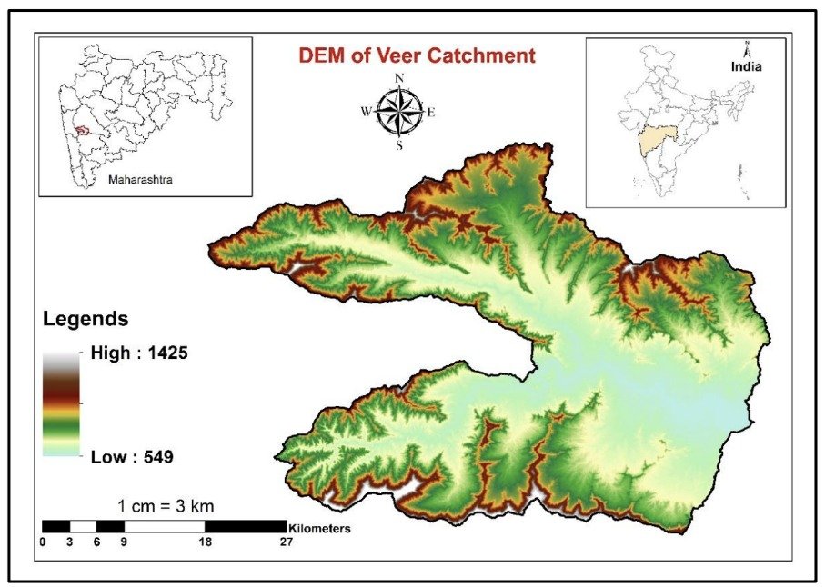
Hydrological Modeling for Veer Catchment
Jun 2015 - May 2019
B.Tech dissertation on Hydrological Modeling using SWAT-GIS Interface for comprehensive watershed analysis and water resource planning.
Publications

2025
How are Droughts Monitored and Declared in India? Subdistrict Level Analysis of Maharashtra Drought 2023
Under Review
2025
Geospatial Modeling in Assessing Watershed Ecosystem Services for Conservation Planning
Environmental Earth Sciences (Under Review)
Awards & Recognition
Scholarship for Meritorious Students for Higher Education Abroad
Government of Maharashtra
Sharad Pawar Inspire Fellowship in Agriculture
2022
NSS Certificate
National Service Scheme
NCC Grade 'A' Certificate
National Cadet Corps - 2012